Communicating for > Land + environment
The interpretation of landscapes, and informing the relationships we grow with them, is work at the heart of my practice.
Thanks to early work with Australian Geographic and Wild magazines, I took an interest in maps, trail design, and environmental interpretation that sparked a fascination with landscape storytelling. I hold a Graduate Certificate in Landscape Architecture, a Certificate in Sustainable Leadership, and I’ve studied at the Australian School of Urban Forestry. I’ve been a comms strategist and storyteller for the Banff Mountain Film and Book Festival, Ocean Film Festival Australia, Healthy Waters Partnership for the Dry Tropics, and National Arboretum Canberra, and I’ve worked closely with Geoscience Australia’s Digital Earth program on multiple projects.
Satellites empower environmental science
When Landsat 1, the first Earth observation satellite, launched in 1972, less than half the Earth had been accurately mapped.
The data Landsat provided led to a re-mapping of Antarctica, the creation of the first worldwide glacier map, and a new understanding of the Amazon’s true positioning.
For more than 50 years, Landsat has shown the power of remote sensing data to reveal our planet’s true face.
Today, satellite imagery continues to uncover new knowledge about our lands, waterways and coasts and Australian scientists, conservationists and environmental managers are proving to be natural leaders in the clever application of Earth observations.
Digital Earth Australia (DEA) is a program of Geoscience Australia, an agency of the Australian Government. It makes more than 30 years of landscape imagery and data from US and European satellites freely available for Australians to download, and to access via web tools and services.
DEA provides national-scale imagery that shows Australian landscapes in unprecedented detail — revealing how our environments have changed over time and supporting research into changes in canopy cover, wetlands ecosystems, coastal environments, biodiversity, the impacts of sea level rise and climate changes.
DEA equips government, industry and communities with organised, analysis-ready data and high-performance computing infrastructure, unlocking the value of satellite observations for planning, monitoring and problem solving. Learn more
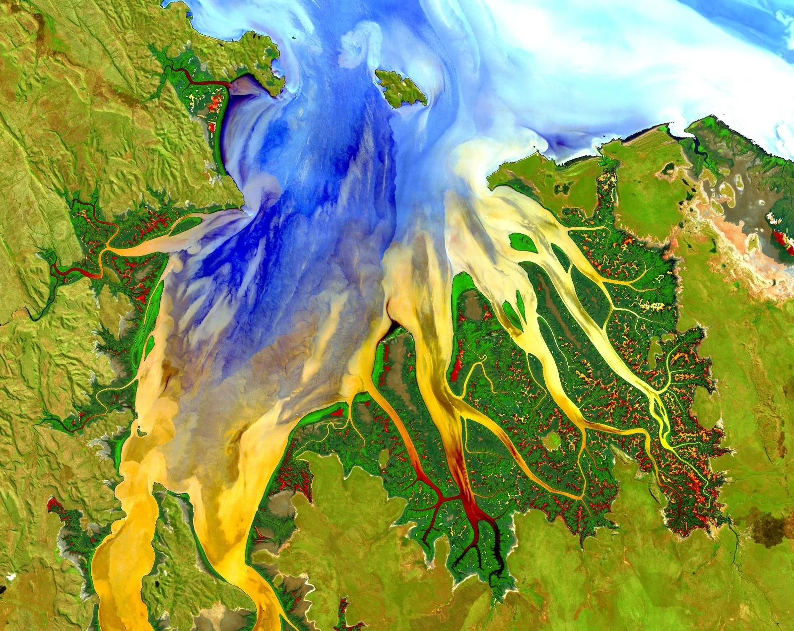
Image: A portion of the first Landsat 8 scene acquired May 12, 2013 in Western Australia. Geoscience Australia produced this enhanced image by first masking water and land pixels, separately enhancing both, then reassembling the image to highlight sediment and nutrient patterns in the tropical estuary area and complexities in vegetated areas.
Unleashing community energy
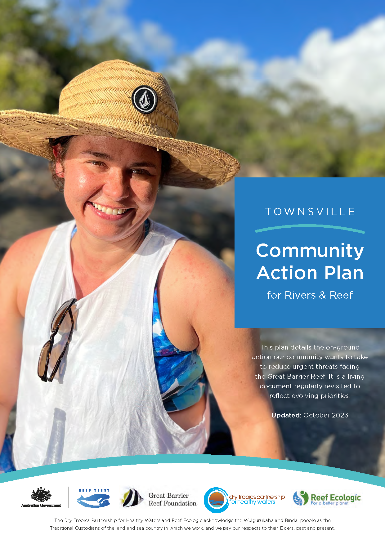
Townsville Community Action Plan for Rivers & Reef
Waterways are the lifeblood of Townsville and the Dry Tropics.
Flowing from the foothills of the Hervey and Mount Stuart ranges and through our town of almost 200,000 people, tributaries of the Ross and Black River Catchments wend their way through rich riparian ecosystems and Ramsar-listed wetlands, into Cleveland and Halifax Bays, and ultimately onto the iconic Great Barrier Reef World Heritage Area.
The people of Townsville fish, walk, swim, paddle, sail, dive, live, and work with their waterways and awareness of the critical flow-on effects of inland waterway health on the state of local coasts and Reef is growing.
The outstanding natural heritage values of the Townsville region, the city’s position as an internationally renowned marine research and tourism hub, and Townsville’s role as the country’s leading point of export for a host of mineral and agricultural exports, are all factors that combine to see Townsville well positioned to address its waterways concerns.
Local knowledge is local power
Development of the Townsville Community Action Plan brought a diversity of people together from across the Townsville region to discuss key issues and practical ideas for the local marine and coastal environment.
The community showed it is increasingly conscious of the potential collective impact it can have on local waterways and the Great Barrier Reef, and the Action Plan articulates its shared priorities and goals.
See the Community Action Plan here.
The psychology of water
New StoryMap reveals the highs and lows of local waterways
Townsville’s Cleveland Bay is a dynamic and dramatic place for water.
Rain comes in massive peaks and troughs, cyclones tear across the ocean, and winds and currents stir the coast into a swirling mix of salt, sand, and sediment.
This week the Healthy Waters Partnership for the Dry Tropics releases a learning experience that shows the many influences at play on the water in our bay — from mountainous topography to the constructed weirs and breakwalls of our town.
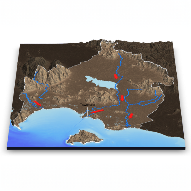
‘The Hydrology and Hydrodynamics of Cleveland Bay’ is a StoryMap that takes readers for a ride with our local waters on their journey to the sea.
“Hydrology and hydrodynamics explain the psychology of water,” says Executive Officer, Kara-Mae Coulter-Atkins: “Why it behaves the way it does, where it really goes, the pressures it is under, and the conditions that steer its direction and momentum.
“Greater understanding of how water moves through our landscapes empowers our community, waterway managers, developers, and scientists to better support the health of our waters.”
Behind the creation of a StoryMap
An ArcGIS StoryMap is a web-based application provided by Geographic Information System (GIS) software company Esri. It allows users to combine maps, multimedia content, and narrative text to create engaging and informative web stories.
Partnership Technical Officer Adam Shand has been busy this year wielding the powers of the coding language ‘R’ to render maps of our local mountains, bays, and coastal landforms for the new Hydrology and Hydrodynamics StoryMap.
One move for Sydney’s Moore Park
Restoring the goat tracks of a layered links
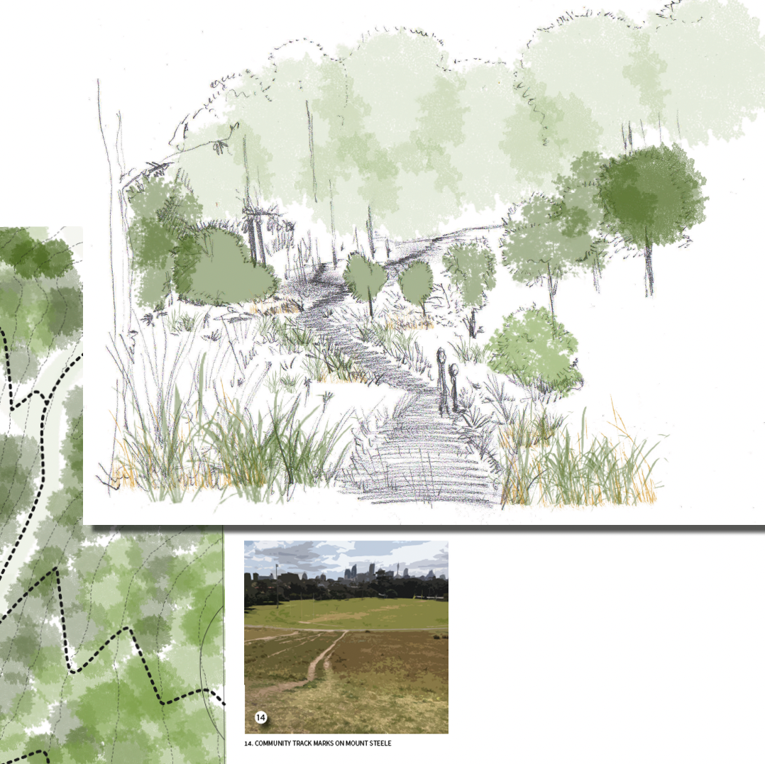
Where walkers and runners have paced the limited boundaries of Sydney’s Moore Park Golf Course for over a century, natural trails have marked time through the area’s fraught history – scratching the tensions of a changing city, and an ever-accelerating loss of natural vegetation – into the landscape.
The proposed Goat Track Trail Project draws on the working-class roots of the Redfern/Waterloo/Eveleigh area and leverages the unpolished grit of new and existing ‘goat tracks’.
Unpaved tracks create a place that invites co-authorship by the local community; that honours native plants and birds as site stakeholders; and that celebrates the soils of a hilly landform which has held significance for peoples of the area for thousands of years.
In a once treed landscape, Goat Tracks restores native vegetation and educates visitors about the importance of water scarcity in shaping Sydney’s story and landscapes — past and present.
It recovers an abused hillside, contributes to Sydney City canopy targets, provides a gateway to the former Moore Park Golf Course, and nods to the roots of the Redfern/Waterloo area.
Studies show that recreational walking and running for psychological and physical health has never been more popular, enjoyed almost equally among women and men in Australia. Trail walking and running through natural environments have been closely linked to improved mental health, pro-environmental behaviours, and lessened impact on joints when compared to pounding pavements. Unpaved trail networks are also flexible and cost-effective as park demands change.